
- Start >
- Rivers >
- Waterlevel >
- Bayern >
- Trausnitz u. d. Mühle >
- Chart of month

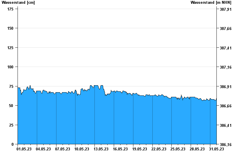
Chart of month Trausnitz u. d. Mühle / Pfreimd
Waterlevel from 01.05.2023 to 31.05.2023
- 26.01.1995 Wasserstand: 259 cm
- 03.01.2003 Wasserstand: 252 cm
- 27.03.1988 Wasserstand: 252 cm
- 22.12.1993 Wasserstand: 236 cm
- 14.01.2011 Wasserstand: 234 cm
| Date | Waterlevel [cm] |
|---|---|
| 01.06.2023 00:45 | 59 |
| 01.06.2023 00:30 | 59 |
| 01.06.2023 00:15 | 59 |
| 01.06.2023 00:00 | 59 |
| 31.05.2023 23:45 | 59 |
| 31.05.2023 23:30 | 59 |
| 31.05.2023 23:15 | 59 |
© Bayerisches Landesamt für Umwelt 2024