
- Start >
- Rivers >
- Waterlevel >
- Bayern >
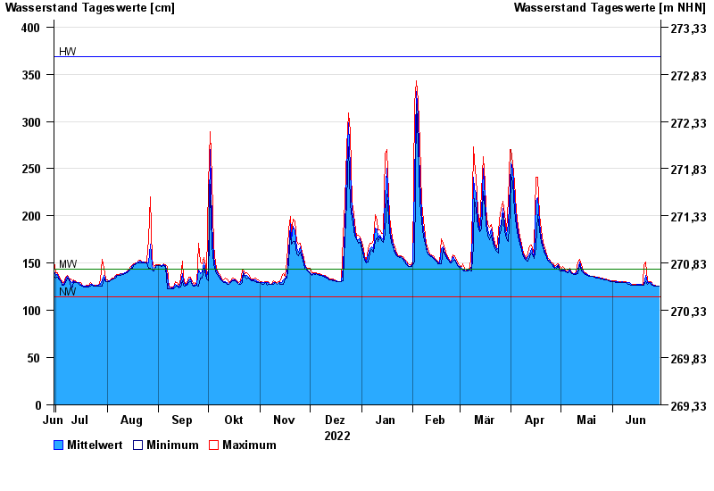
- Schönbrunn >
- Chart of year

Chart of year Schönbrunn / Rauhe Ebrach
Waterlevel from 30.06.2022 to 29.06.2023
note
Beeinflussung des Abflusses aufgrund Hindernisse im Unterlauf
| Date | Mean value [cm] | Maximum [cm] | Minimum [cm] |
|---|---|---|---|
| 29.06.2023 | 126 | 126 | 126 |
| 28.06.2023 | 126 | 126 | 126 |
| 27.06.2023 | 126 | 127 | 126 |
| 26.06.2023 | 127 | 127 | 126 |
| 25.06.2023 | 127 | 128 | 127 |
| 24.06.2023 | 129 | 130 | 128 |
| 23.06.2023 | 129 | 130 | 129 |
© Bayerisches Landesamt für Umwelt 2024