
- Start >
- Rivers >
- Waterlevel >
- Bayern >
- Rosenheim >
- Chart of month

Chart of month Rosenheim / Hammerbach
Waterlevel from 31.07.2022 to 30.08.2022
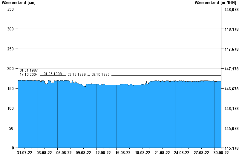
- 31.01.1987 Wasserstand: 191 cm
- 01.06.1998 Wasserstand: 182 cm
- 17.10.2004 Wasserstand: 181 cm
- 02.12.1999 Wasserstand: 181 cm
- 09.10.1995 Wasserstand: 181 cm
| Date | Waterlevel [cm] |
|---|---|
| 31.08.2022 00:45 | 168 |
| 31.08.2022 00:30 | 168 |
| 31.08.2022 00:15 | 168 |
| 31.08.2022 00:00 | 167 |
| 30.08.2022 23:45 | 167 |
| 30.08.2022 23:30 | 167 |
| 30.08.2022 23:15 | 167 |
© Bayerisches Landesamt für Umwelt 2024