
- Start >
- Rivers >
- Waterlevel >
- Bayern >
- Moosburg >
- Chart of year

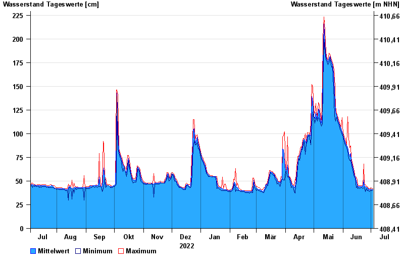
Chart of year Moosburg / Amper
Waterlevel from 04.07.2022 to 03.07.2023
- 05.06.2013 Wasserstand: 363 cm
- 08.08.2010 Wasserstand: 272 cm
- 04.06.2010 Wasserstand: 257 cm
- 03.02.2013 Wasserstand: 242 cm
- 15.01.2019 Wasserstand: 241 cm
| Date | Mean value [cm] | Maximum [cm] | Minimum [cm] |
|---|---|---|---|
| 03.07.2023 | 41 | 42 | 41 |
| 02.07.2023 | 41 | 42 | 40 |
| 01.07.2023 | 41 | 43 | 40 |
| 30.06.2023 | 41 | 42 | 40 |
| 29.06.2023 | 41 | 42 | 39 |
| 28.06.2023 | 41 | 42 | 40 |
| 27.06.2023 | 43 | 44 | 40 |
© Bayerisches Landesamt für Umwelt 2024