
- Start >
- Rivers >
- Waterlevel >
- Bayern >
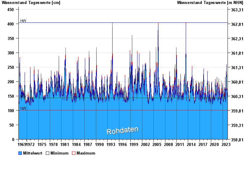
- Manching Bahnbrücke >
- Chart of total period

Chart of total period Manching Bahnbrücke / Paar
Waterlevel from 01.11.1969 to 18.04.2024
note
Beachte: Abflussmessung 2017 eingestellt, Abflussdaten nicht korrekt!
| Date | Mean value [cm] | Maximum [cm] | Minimum [cm] |
|---|---|---|---|
| 18.04.2024 | 147 | 148 | 146 |
| 17.04.2024 | 138 | 147 | 133 |
| 16.04.2024 | 132 | 137 | 128 |
| 15.04.2024 | 126 | 128 | 125 |
| 14.04.2024 | 126 | 126 | 124 |
| 13.04.2024 | 126 | 128 | 124 |
| 12.04.2024 | 126 | 127 | 125 |
© Bayerisches Landesamt für Umwelt 2024