
- Start >
- Rivers >
- Waterlevel >
- Bayern >
- Kalteneck >
- Chart of total period

Chart of total period Kalteneck / Ilz
Waterlevel from 01.02.1900 to 25.04.2024
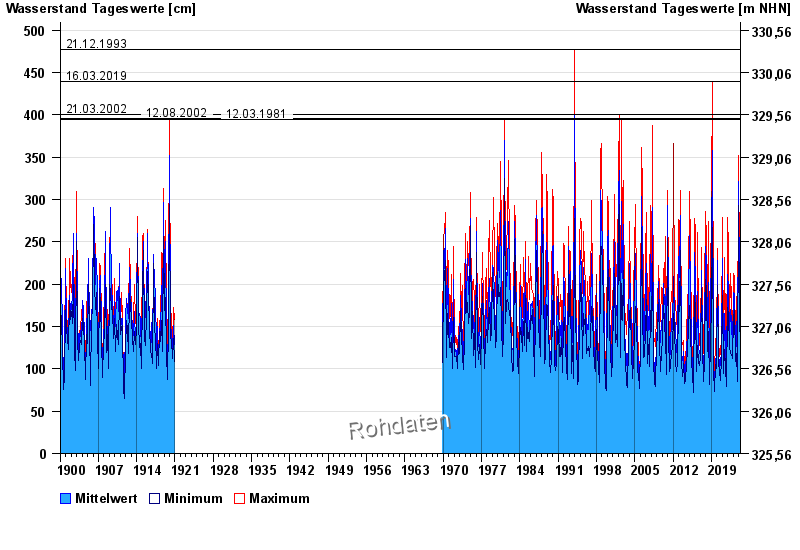
- 21.12.1993 Wasserstand: 477 cm
- 16.03.2019 Wasserstand: 439 cm
- 21.03.2002 Wasserstand: 400 cm
- 12.08.2002 Wasserstand: 396 cm
- 12.03.1981 Wasserstand: 395 cm
| Date | Mean value [cm] | Maximum [cm] | Minimum [cm] |
|---|---|---|---|
| 25.04.2024 | 92 | 93 | 91 |
| 24.04.2024 | 93 | 96 | 88 |
| 23.04.2024 | 96 | 99 | 91 |
| 22.04.2024 | 103 | 108 | 98 |
| 21.04.2024 | 117 | 131 | 107 |
| 20.04.2024 | 136 | 140 | 128 |
| 19.04.2024 | 99 | 126 | 93 |
© Bayerisches Landesamt für Umwelt 2024