
- Start >
- Rivers >
- Waterlevel >
- Bayern >
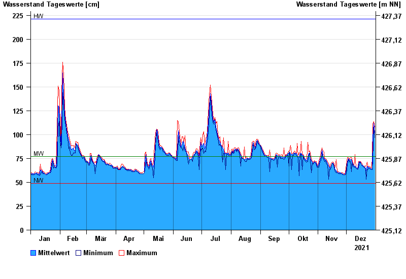
- Johannisthal >
- Chart of year

Chart of year Johannisthal / Tirschenreuther Waldnaab
Waterlevel from 01.01.2021 to 31.12.2021
| Date | Mean value [cm] | Maximum [cm] | Minimum [cm] |
|---|---|---|---|
| 31.12.2021 | 102 | 108 | 97 |
| 30.12.2021 | 112 | 114 | 108 |
| 29.12.2021 | 97 | 111 | 74 |
| 28.12.2021 | 65 | 74 | 63 |
| 27.12.2021 | 64 | 65 | 64 |
| 26.12.2021 | 65 | 66 | 64 |
| 25.12.2021 | 66 | 67 | 65 |
© Bayerisches Landesamt für Umwelt 2024