
- Start >
- Rivers >
- Waterlevel >
- Bayern >
- Garmisch o. d. Partnachmündung >
- Chart of year

Chart of year Garmisch o. d. Partnachmündung / Loisach
Waterlevel from 05.12.2022 to 04.12.2023
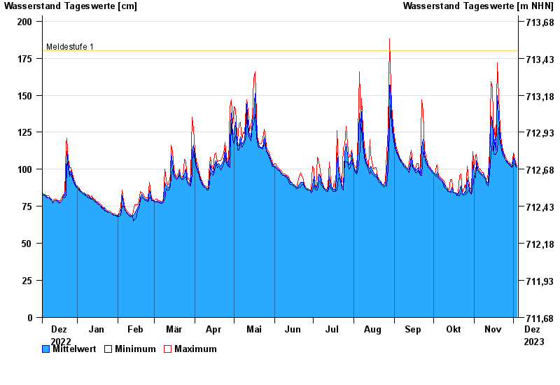
- Meldestufe 1 180 cm
- Meldestufe 4 260 cm
- Hochwassergefahrenfläche HQ100 330 cm
| Date | Mean value [cm] | Maximum [cm] | Minimum [cm] |
|---|---|---|---|
| 04.12.2023 | 102 | 102 | 101 |
| 03.12.2023 | 103 | 105 | 102 |
| 02.12.2023 | 107 | 109 | 104 |
| 01.12.2023 | 108 | 111 | 103 |
| 30.11.2023 | 102 | 103 | 101 |
| 29.11.2023 | 102 | 103 | 102 |
| 28.11.2023 | 104 | 105 | 103 |
© Bayerisches Landesamt für Umwelt 2024