
- Start >
- Rivers >
- Waterlevel >
- Bayern >
- Frammersbach >
- Chart of year

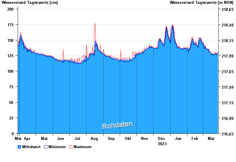
Chart of year Frammersbach / Lohr
Waterlevel from 29.03.2023 to 28.03.2024
- Hochwassergefahrenfläche HQ100 240 cm
| Date | Mean value [cm] | Maximum [cm] | Minimum [cm] |
|---|---|---|---|
| 28.03.2024 | 129 | 131 | 128 |
| 27.03.2024 | 129 | 131 | 128 |
| 26.03.2024 | 127 | 129 | 126 |
| 25.03.2024 | 127 | 128 | 126 |
| 24.03.2024 | 128 | 129 | 127 |
| 23.03.2024 | 129 | 131 | 128 |
| 22.03.2024 | 127 | 129 | 127 |
© Bayerisches Landesamt für Umwelt 2024