
- Start >
- Rivers >
- Waterlevel >
- Bayern >
- Eberhardsreuth >
- Chart of month

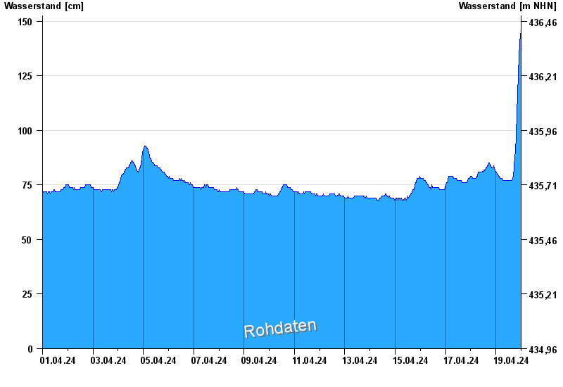
Chart of month Eberhardsreuth / Mitternacher Ohe
Waterlevel from 01.04.2024 to 19.04.2024
- Hochwassergefahrenfläche HQ100 260 cm
| Date | Waterlevel [cm] |
|---|---|
| 19.04.2024 11:45 | 76 |
| 19.04.2024 11:30 | 77 |
| 19.04.2024 11:15 | 76 |
| 19.04.2024 11:00 | 76 |
| 19.04.2024 10:45 | 76 |
| 19.04.2024 10:30 | 77 |
| 19.04.2024 10:15 | 76 |
© Bayerisches Landesamt für Umwelt 2024