
- Start >
- Rivers >
- Waterlevel >
- Bayern >
- Dillingen >
- Chart of month

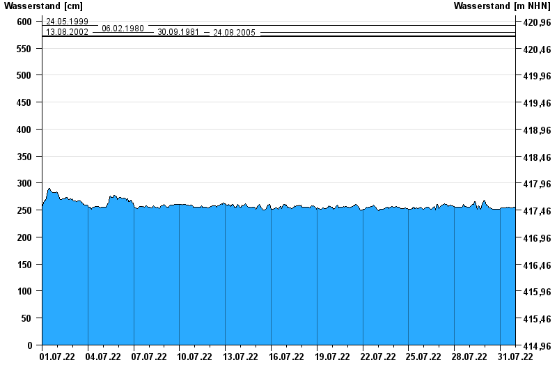
Chart of month Dillingen / Donau
Waterlevel from 01.07.2022 to 31.07.2022
ACHTUNG!
Abflussermittlung bei Niedrigwasser beeinflusst.
- 24.05.1999 Wasserstand: 592 cm
- 06.02.1980 Wasserstand: 579 cm
- 13.08.2002 Wasserstand: 573 cm
- 30.09.1981 Wasserstand: 573 cm
- 24.08.2005 Wasserstand: 572 cm
| Date | Waterlevel [cm] |
|---|---|
| 01.08.2022 00:45 | 255 |
| 01.08.2022 00:30 | 255 |
| 01.08.2022 00:15 | 255 |
| 01.08.2022 00:00 | 255 |
| 31.07.2022 23:45 | 255 |
| 31.07.2022 23:30 | 255 |
| 31.07.2022 23:15 | 255 |
© Bayerisches Landesamt für Umwelt 2024