
- Start >
- Rivers >
- Waterlevel >
- Bayern >
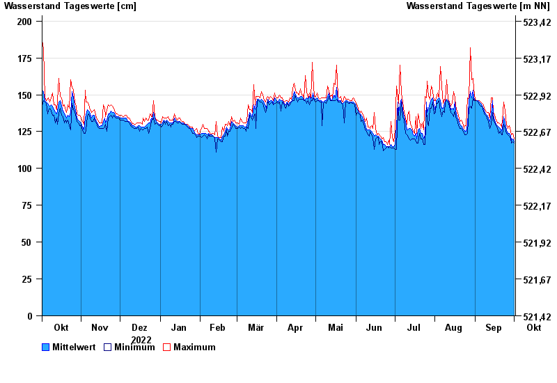
- Dickertsmühle >
- Chart of year

Chart of year Dickertsmühle / Mühlbach
Waterlevel from 02.10.2022 to 01.10.2023
- 06.08.2000 Wasserstand: 293 cm
- 04.08.2020 Wasserstand: 262 cm
- 21.06.1983 Wasserstand: 250 cm
- 01.06.2013 Wasserstand: 248 cm
- 12.06.1988 Wasserstand: 247 cm
| Date | Mean value [cm] | Maximum [cm] | Minimum [cm] |
|---|---|---|---|
| 01.10.2023 | 118 | 120 | 117 |
| 30.09.2023 | 120 | 124 | 118 |
| 29.09.2023 | 119 | 123 | 117 |
| 28.09.2023 | 122 | 125 | 120 |
| 27.09.2023 | 124 | 129 | 122 |
| 26.09.2023 | 124 | 127 | 123 |
| 25.09.2023 | 126 | 130 | 124 |
© Bayerisches Landesamt für Umwelt 2024