
- Start >
- Rivers >
- Discharge >
- Untere Donau >
- Neustift >
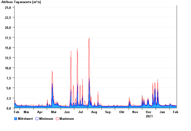
- Chart of year

Chart of year Neustift / Wolfach
Discharge from 17.02.2021 to 16.02.2022
- 08.08.1968 Abfluss: 93,8 m³/s
- 20.08.1966 Abfluss: 72,3 m³/s
- 22.02.1970 Abfluss: 59,7 m³/s
- 18.11.1964 Abfluss: 55,8 m³/s
- 12.02.2005 Abfluss: 54,9 m³/s
| Date | Mean value [m³/s] | Maximum [m³/s] | Minimum [m³/s] |
|---|---|---|---|
| 16.02.2022 | 0.557 | 0.706 | 0.433 |
| 15.02.2022 | 0.599 | 0.707 | 0.516 |
| 14.02.2022 | 0.556 | 0.667 | 0.482 |
| 13.02.2022 | 0.569 | 0.668 | 0.484 |
| 12.02.2022 | 0.582 | 0.668 | 0.484 |
| 11.02.2022 | 0.594 | 0.669 | 0.518 |
| 10.02.2022 | 0.57 | 0.63 | 0.318 |
© Bayerisches Landesamt für Umwelt 2024