
- Start >
- Rivers >
- Discharge >
- Isar >
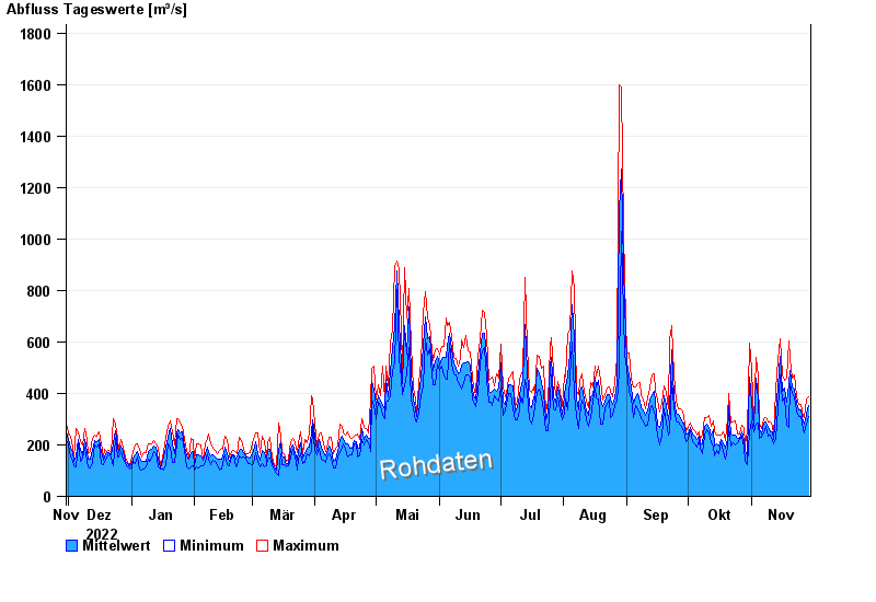
- Rosenheim o.d. Mangfallmündung >
- Chart of year

Chart of year Rosenheim o.d. Mangfallmündung / Inn
Discharge from 30.11.2022 to 29.11.2023
| Date | Mean value [m³/s] | Maximum [m³/s] | Minimum [m³/s] |
|---|---|---|---|
| 29.11.2023 | 352 | 386 | 309 |
| 28.11.2023 | 317 | 379 | 281 |
| 27.11.2023 | 282 | 306 | 246 |
| 26.11.2023 | 290 | 309 | 261 |
| 25.11.2023 | 336 | 359 | 309 |
| 24.11.2023 | 334 | 359 | 309 |
| 23.11.2023 | 361 | 389 | 330 |
© Bayerisches Landesamt für Umwelt 2024