
- Start >
- Lakes >
- Waterlevel >
- Bayern >
- St. Quirin >
- Chart of year

Chart of year St. Quirin / Tegernsee
Waterlevel from 17.05.2022 to 16.05.2023
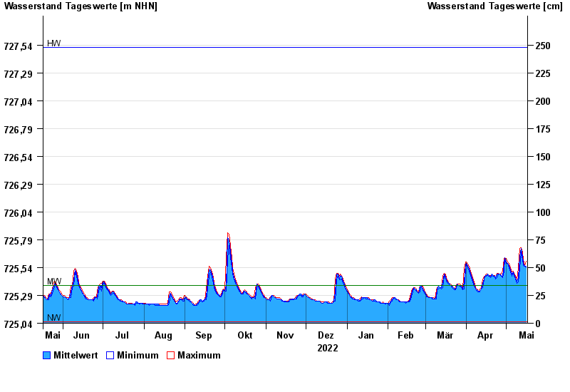
Linien: keine | Hauptwerte | Meldestufen | mittlerer Seespiegel | Hochwassermarken | historische Ereignisse
| Date | Mean value [m above sealevel] | Maximum [m above sealevel] | Minimum [m above sealevel] |
|---|---|---|---|
| 16.05.2023 | 725.55 | 725.60 | 725.54 |
| 15.05.2023 | 725.56 | 725.56 | 725.55 |
| 14.05.2023 | 725.58 | 725.61 | 725.56 |
| 13.05.2023 | 725.64 | 725.68 | 725.61 |
| 12.05.2023 | 725.71 | 725.72 | 725.68 |
| 11.05.2023 | 725.64 | 725.71 | 725.53 |
| 10.05.2023 | 725.45 | 725.53 | 725.41 |
© Bayerisches Landesamt für Umwelt 2024