
- Start >
- Lakes >
- Biology >
- Iller - Lech - Bodensee >
- Tiefste Stelle >
- Master data

Master data Tiefste Stelle
Site number: 2161
Community: Halblech
District: Ostallgäu
Operator: WWA Kempten
Body of water: Forggensee
Catchment: --
Easting: 631059 (ETRS89 / UTM Zone 32N)
Northing: 5279314
- state measurement sites
For the measurement site Tiefste Stelle at the moment no extended master data available.
Picture of the measurement site
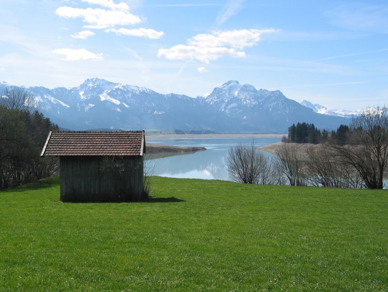
Location of the station Tiefste Stelle / Forggensee
| Measurement site | Category |
|---|---|
 Lechbruck Lechbruck | Rivers: Runoff, Waterlevel |
| Pfronten Ried | Rivers: Runoff, Waterlevel |
| Eschach | Rivers: Runoff, Waterlevel |
| Trauchgau | Rivers: Runoff, Waterlevel |
| Engen | Rivers: Runoff, Waterlevel, Water temperature, Water temperature |
| Thalhofen | Rivers: Runoff, Waterlevel |
| Biessenhofen | Rivers: Runoff, Waterlevel |
| Görisried | Rivers: Runoff, Waterlevel |
| Leuterschach | Rivers: Runoff, Waterlevel |
| Hörmanshofen | Rivers: Runoff, Waterlevel |
| Füssen | Rivers: Runoff, Waterlevel, Suspended sediment |
| Brunnen | Rivers: Runoff, Waterlevel |
| Füssen (virtuell) | Rivers: Runoff |
| Trauchgau | Rivers: Runoff, Waterlevel |
| Unterthingau | Rivers: Runoff, Waterlevel, Water temperature, Water temperature |
| Unternogg | Rivers: Runoff, Waterlevel |
| Fallmühle | Rivers: Runoff, Waterlevel |
| Griesen | Rivers: Runoff, Waterlevel |
| Roßhaupten Seepegel | Lakes: Waterlevel |
| Vilsen | Lakes: Waterlevel |
| Moos | Lakes: Waterlevel |
| Schwangau | Lakes: Waterlevel |
| Mühlberg | Lakes: Waterlevel |
| Tiefste Stelle | Lakes: Chemistry, Biology |
| Tiefste Stelle | Lakes: Chemistry, Biology |
| Tiefste Stelle | Lakes: Chemistry, Biology |
| Tiefste Stelle | Lakes: Chemistry, Biology |
| Füssen, Magnustritt | Rivers: Chemistry, Biology |
| uh. Proner Brücke | Rivers: Chemistry, Biology |
| oh Rudersau | Rivers: Chemistry, Biology |
| uh Staustufe 4 | Rivers: Chemistry, Biology |
| Litzauer Schleife | Rivers: Chemistry, Biology |
| Br ca 2.5km oh Mdg | Rivers: Chemistry, Biology |
| Br 1km oh Mdg (Chemiemssstelle) | Rivers: Chemistry |
| Bruecke Unternogg | Rivers: Chemistry, Biology |
| Straßenbr. bei Hausen | Rivers: Chemistry, Biology |
| uh Bruecke St2014 | Rivers: Chemistry, Biology |
| Straßenbr. oh. Lechbruck | Rivers: Chemistry, Biology |
| Wegbrücke oh. Hopfensee | Rivers: Chemistry, Biology |
| oh. Mündung in die Wertach | Rivers: Chemistry, Biology |
| Oh. Strßenbr. Meilingen | Rivers: Chemistry, Biology |
| 100m uh Lexenbach | Rivers: Chemistry, Biology |
| Brücke Görisried-Wald (Barnsteiner Br.) | Rivers: Chemistry, Biology |
| 100m oh Br B 23 | Rivers: Chemistry, Biology |
| Uh. ehem. Deponie Füssen | Rivers: Chemistry, Biology |
| Br. oh. Papierfabrik Eul & Günther | Rivers: Chemistry, Biology |
| Wegbr. oh. Josenmühle | Rivers: Chemistry, Biology |
| Uh. Mü. Röthenbach | Rivers: Chemistry, Biology |
| Straßenb. oh. Mdg. | Rivers: Chemistry, Biology |
| Uh. Mdg. Kirnach-Hochwasserlauf, uh Aitrang | Rivers: Chemistry, Biology |
| Furt oh. Görisried | Rivers: Chemistry, Biology |
| Tiefste Stelle | Lakes: Chemistry, Biology |
| Pegel Thalhofen, oh. Brücke | Rivers: Biology |
| Uh. Mdg. Stöttener Mühlbach | Rivers: Biology |
| oh Ammermühle,800m O Rottenbuch,Fkm 158 | Rivers: Biology |
| zw Apfeldorf u Kinsau,oh Apfeldorfer Br,Fkm 112,8 | Rivers: Biology |
| Ortsbereich Hohenfurch - 1 Br westl B17 | Rivers: Biology |
| 150m oh Muendung Schoenach | Rivers: Biology |
| Uh KW AÜW | Rivers: Biology |
| Tiefste Stelle | Lakes: Biology |
| Lechstausee Dornau - Staustufe 6 | Lakes: Biology |
| Transekt H 1 | Lakes: Biology |
| Transekt H 2 | Lakes: Biology |
| Transekt H 3 | Lakes: Biology |
| Transekt H 4 | Lakes: Biology |
| Transekt H 5 | Lakes: Biology |
| Transekt H 6 | Lakes: Biology |
| Transekt H 7 | Lakes: Biology |
| Transekt H 8 | Lakes: Biology |
| Transekt B4 | Lakes: Biology |
| Transekt B5 | Lakes: Biology |
| Transekt B6 | Lakes: Biology |
| Transekt B7 | Lakes: Biology |
| Transekt B8 | Lakes: Biology |
| Transekt W1 | Lakes: Biology |
| Transekt W2 | Lakes: Biology |
| Transekt W3 | Lakes: Biology |
| Transekt W4 | Lakes: Biology |
| Transekt W5 | Lakes: Biology |
| Transekt W6 | Lakes: Biology |
| Transekt W7 | Lakes: Biology |
| Transekt 1 - westlich der Wasserwacht | Lakes: Biology |
| Transekt 2 - westlicher Teil des Badestrand | Lakes: Biology |
| Transekt 3 - Suedufer a.H. Steilufer | Lakes: Biology |
| Transekt 4 - Suedwestufer uh Parkbank | Lakes: Biology |
| Transekt 5 - Nordwestufer gegenueber Scheibeninsel | Lakes: Biology |
| Transekt 6 - Nordufer bei Steingringpriel | Lakes: Biology |
| Transekt 7 - oestlich Sachseninsel | Lakes: Biology |
| Transekt 8 - mittig Ostufer Untersee | Lakes: Biology |
| Transekt 1 | Lakes: Biology |
| Transekt 2 | Lakes: Biology |
| Transekt 3 | Lakes: Biology |
| Transekt 4 | Lakes: Biology |
| Transekt 5 | Lakes: Biology |
| Transekt 6 | Lakes: Biology |
| Transekt 8 | Lakes: Biology |
| Transekt 7 | Lakes: Biology |
| Transekt W5a | Lakes: Biology |
| Transekt Fo-01 | Lakes: Biology |
| Transekt Fo-02 | Lakes: Biology |
| Transekt Fo-03 | Lakes: Biology |
| Transekt Fo-04 | Lakes: Biology |
| Transekt Fo-05 | Lakes: Biology |
| Transekt Fo-06 | Lakes: Biology |
| Transekt Fo-07 | Lakes: Biology |
| Transekt Fo-08 | Lakes: Biology |
| Transekt Fo-09 | Lakes: Biology |
| Transekt Fo-10 | Lakes: Biology |
| Transekt Fo-11 | Lakes: Biology |
| Transekt Fo-12 | Lakes: Biology |
| Transekt B1a | Lakes: Biology |
| Transekt B2a | Lakes: Biology |
| Transekt B3a | Lakes: Biology |
| Transekt W1a | Lakes: Biology |
| Transekt W3a | Lakes: Biology |
| Transekt W7a | Lakes: Biology |
| Transekt 1 | Lakes: Biology |
| Transekt 2 | Lakes: Biology |
| Transekt 3 | Lakes: Biology |
| Transekt 4 | Lakes: Biology |
| Transekt 5 | Lakes: Biology |
| Transekt 6 | Lakes: Biology |
| Transekt 7 | Lakes: Biology |
| Transekt 8 | Lakes: Biology |
| PEITING WV 872 TR | Groundwater: Upper groundwater layer |
| EBENHOFEN 758 | Groundwater: Upper groundwater layer |
| Unterlöchlers | Groundwater: Flow of well, Temperature of springs |
| Görisried Quelle Nord | Groundwater: Flow of well, Temperature of springs |
| GEISENRIED P4 | Groundwater: Upper groundwater layer |
| Säulingquellen | Groundwater: Flow of well, Temperature of springs |
| 4110812900015 | Groundwater: Chemistry |
| 4110813000027 | Groundwater: Chemistry |
| 4110843000018 | Groundwater: Chemistry |
| 4120812800038 | Groundwater: Chemistry |
| 4120822900034 | Groundwater: Chemistry |
| 4120832900062 | Groundwater: Chemistry |
| 4120833100022 | Groundwater: Chemistry |
| 4120843000028 | Groundwater: Chemistry |
| 4110822900002 | Groundwater: Chemistry |
| 1131823100037 | Groundwater: Chemistry |
| 4120833000015 | Groundwater: Chemistry |
| 1131812900259 | Groundwater: Chemistry |
| 1131823100062 | Groundwater: Chemistry |
| 1131812900194 | Groundwater: Chemistry |
| 1131833000117 | Groundwater: Chemistry |
| 1131833100035 | Groundwater: Chemistry |
| 1131813000101 | Groundwater: Chemistry |
| 1131833000122 | Groundwater: Chemistry |
| Ettal-Linderhof | Meteorology: Precipitation, Snow |
| Halblech-Buching | Meteorology: Precipitation, Snow |
| Marktoberdorf-Sulzschneid | Meteorology: Precipitation, Snow |
| Bernbeuren-Prachtsried | Meteorology: Precipitation, Snow |
| Seeg | Meteorology: Precipitation, Snow |
| Schwangau-Horn (LfU) | Meteorology: Precipitation, Snow |
| Untergschwend/Österreich | Meteorology: Precipitation |
| Garmisch-Partenkirchen-Griesen | Meteorology: Precipitation |
| Tegelberg 1710m | Meteorology: Snow, Air temperatur, Air moisture, Air pressure |
| Trauchgau | Meteorology: Wind, Air temperatur, Air moisture, Air pressure, Global radiation |
| Steingaden | Meteorology: Wind, Air temperatur, Air moisture, Global radiation |
© Bayerisches Landesamt für Umwelt 2024