
- Start >
- Groundwater >
- Waterlevel of upper layer >
- Untere Donau >
- UNTERE ISAR SP 65 >
- Chart of total period

Chart of total period UNTERE ISAR SP 65
Groundwater levels of the total period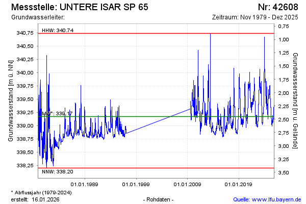
Groundwater level [m above sealevel]: 339.81
Distance to surface [m]: 1.81
Last value from 20.02.2024 10:25
Ground level [m above sealevel]: 341.62
| Date | Groundwater level [m above sealevel] |
|---|---|
| 20.02.2024 | 339.81 |
| 19.02.2024 | 339.82 |
| 18.02.2024 | 339.82 |
| 17.02.2024 | 339.83 |
| 16.02.2024 | 339.85 |
| 15.02.2024 | 339.86 |
| 14.02.2024 | 339.88 |
| 13.02.2024 | 339.89 |
© Bayerisches Landesamt für Umwelt 2024