
- Start >
- Groundwater >
- Waterlevel of upper layer >
- Untere Donau >
- MAINBURG Q2 >
- Chart of total period

Chart of total period MAINBURG Q2
Groundwater levels of the total period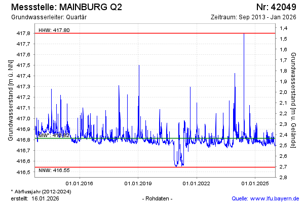
Groundwater level [m above sealevel]: 416.84
Distance to surface [m]: 2.41
Last value from 18.04.2024 10:00
Ground level [m above sealevel]: 419.25
| Date | Groundwater level [m above sealevel] |
|---|---|
| 18.04.2024 | 416.83 |
| 17.04.2024 | 416.81 |
| 16.04.2024 | 416.81 |
| 15.04.2024 | 416.79 |
| 14.04.2024 | 416.78 |
| 13.04.2024 | 416.78 |
| 12.04.2024 | 416.78 |
| 11.04.2024 | 416.78 |
© Bayerisches Landesamt für Umwelt 2024