
- Start >
- Groundwater >
- Waterlevel of upper layer >
- Untere Donau >
- Flussraummanagement Vils ZA 05 >
- Chart of total period

Chart of total period Flussraummanagement Vils ZA 05
Groundwater levels of the total period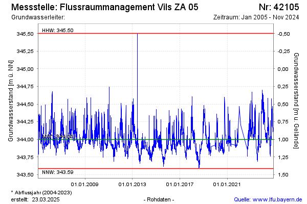
Groundwater level [m above sealevel]: 344.03
Distance to surface [m]: 0.97
Last value from 17.04.2024 09:50
Ground level [m above sealevel]: 345.00
| Date | Groundwater level [m above sealevel] |
|---|---|
| 17.04.2024 | 344.02 |
| 16.04.2024 | 344.00 |
| 15.04.2024 | 343.97 |
| 14.04.2024 | 343.95 |
| 13.04.2024 | 343.95 |
| 12.04.2024 | 343.96 |
| 11.04.2024 | 343.97 |
| 10.04.2024 | 343.97 |
© Bayerisches Landesamt für Umwelt 2024