
- Start >
- Groundwater >
- Waterlevel of upper layer >
- Unterer Main >
- Dietersdorf (KMS1) >
- Chart of total period

Chart of total period Dietersdorf (KMS1)
Groundwater levels of the total period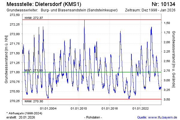
Groundwater level [m above sealevel]: 271.61
Distance to surface [m]: 2.18
Last value from 17.04.2024 10:00
Ground level [m above sealevel]: 273.79
| Date | Groundwater level [m above sealevel] |
|---|---|
| 16.04.2024 | 271.62 |
| 15.04.2024 | 271.61 |
| 14.04.2024 | 271.61 |
| 13.04.2024 | 271.60 |
| 12.04.2024 | 271.61 |
| 11.04.2024 | 271.62 |
| 10.04.2024 | 271.64 |
| 09.04.2024 | 271.67 |
© Bayerisches Landesamt für Umwelt 2024