
- Start >
- Groundwater >
- Waterlevel of upper layer >
- Obere Donau >
- Oberschönegg VB 1t >
- Chart of total period

Chart of total period Oberschönegg VB 1t
Groundwater levels of the total period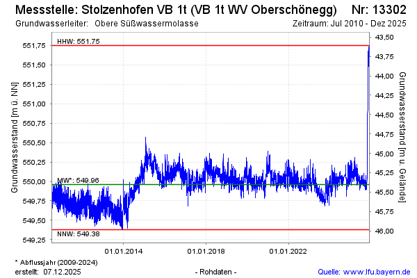
Groundwater level [m above sealevel]: 550.05
Distance to surface [m]: 45.31
Last value from 18.04.2024 08:00
Ground level [m above sealevel]: 595.36
| Date | Groundwater level [m above sealevel] |
|---|---|
| 18.04.2024 | 550.07 |
| 17.04.2024 | 550.05 |
| 16.04.2024 | 550.06 |
| 15.04.2024 | 550.01 |
| 14.04.2024 | 549.92 |
| 13.04.2024 | 549.86 |
| 12.04.2024 | 549.82 |
| 11.04.2024 | 549.80 |
© Bayerisches Landesamt für Umwelt 2024