
- Start >
- Groundwater >
- Waterlevel of upper layer >
- Obere Donau >
- GUN PROMENADE N 7220 >
- Current data

Current data GUN PROMENADE N 7220
Groundwater levels of the last 12 months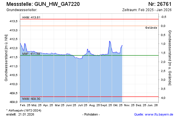
Groundwater level [m above sealevel]: 412.51
Distance to surface [m]: 0.73
Last value from 25.01.2024 13:27
Ground level [m above sealevel]: 413.24
| Date | Groundwater level [m above sealevel] |
|---|---|
| 25.01.2024 | 412.52 |
| 24.01.2024 | 412.48 |
| 23.01.2024 | 412.41 |
| 22.01.2024 | 412.35 |
| 21.01.2024 | 412.35 |
| 20.01.2024 | 412.33 |
| 19.01.2024 | 412.30 |
| 18.01.2024 | 412.27 |
© Bayerisches Landesamt für Umwelt 2024