
- Start >
- Groundwater >
- Waterlevel of upper layer >
- Isar >
- Rehling St. Stephan D36 >
- Chart of total period

Chart of total period Rehling St. Stephan D36
Groundwater levels of the total period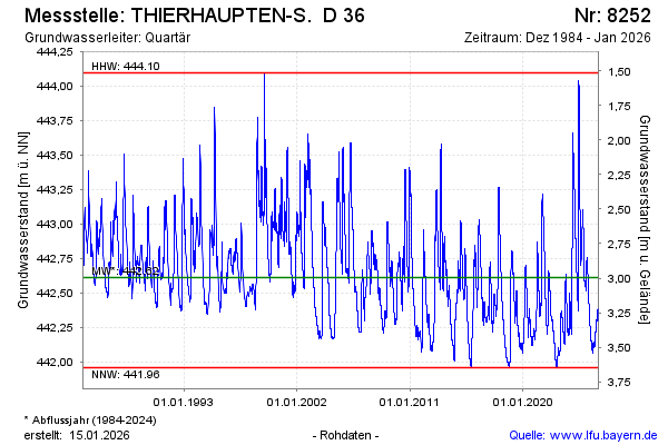
Groundwater level [m above sealevel]: 442.59
Distance to surface [m]: 3.02
Last value from 18.04.2024 07:00
Ground level [m above sealevel]: 445.61
| Date | Groundwater level [m above sealevel] |
|---|---|
| 18.04.2024 | 442.59 |
| 17.04.2024 | 442.59 |
| 16.04.2024 | 442.60 |
| 15.04.2024 | 442.61 |
| 14.04.2024 | 442.61 |
| 13.04.2024 | 442.62 |
| 12.04.2024 | 442.63 |
| 11.04.2024 | 442.64 |
© Bayerisches Landesamt für Umwelt 2024