
- Start >
- Groundwater >
- Waterlevel of upper layer >
- Isar >
- Flussraummanagement Vils ZA 14 >
- Chart of total period

Chart of total period Flussraummanagement Vils ZA 14
Groundwater levels of the total period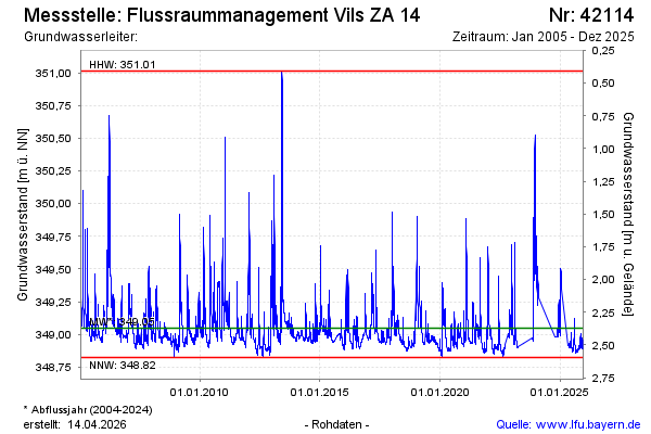
Groundwater level [m above sealevel]: 349.26
Distance to surface [m]: 2.16
Last value from 07.02.2024 11:45
Ground level [m above sealevel]: 351.42
| Date | Groundwater level [m above sealevel] |
|---|---|
| 07.02.2024 | 349.28 |
| 06.02.2024 | 349.29 |
| 05.02.2024 | 349.31 |
| 04.02.2024 | 349.31 |
| 03.02.2024 | 349.31 |
| 02.02.2024 | 349.31 |
| 01.02.2024 | 349.34 |
| 31.01.2024 | 349.38 |
© Bayerisches Landesamt für Umwelt 2024