
- Start >
- Groundwater >
- Waterlevel of upper layer >
- Isar >
- ACHSHEIM 56 >
- Chart of total period

Chart of total period ACHSHEIM 56
Groundwater levels of the total period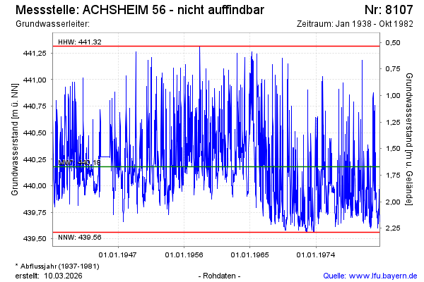
Groundwater level [m above sealevel]: 439.80
Distance to surface [m]: 2.05
Last value from 01.10.1982 12:00
Ground level [m above sealevel]: 441.85
| Date | Groundwater level [m above sealevel] |
|---|---|
| 24.09.1982 | 439.71 |
| 17.09.1982 | 439.66 |
| 10.09.1982 | 439.73 |
| 03.09.1982 | 439.71 |
| 27.08.1982 | 439.73 |
| 20.08.1982 | 439.79 |
| 13.08.1982 | 439.90 |
| 06.08.1982 | 439.97 |
© Bayerisches Landesamt für Umwelt 2024