
- Start >
- Groundwater >
- Waterlevel of upper layer >
- Inn >
- G26 HRB Feldolling >
- Chart of total period

Chart of total period G26 HRB Feldolling
Groundwater levels of the total period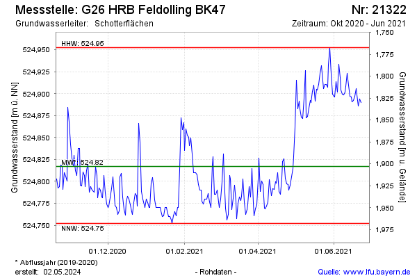
Groundwater level [m above sealevel]: 523.42
Distance to surface [m]: 3.30
Last value from 30.06.2021 07:00
Ground level [m above sealevel]: 526.72
| Date | Groundwater level [m above sealevel] |
|---|---|
| 30.06.2021 | 523.41 |
| 29.06.2021 | 523.41 |
| 28.06.2021 | 523.41 |
| 27.06.2021 | 523.40 |
| 26.06.2021 | 523.41 |
| 25.06.2021 | 523.40 |
| 24.06.2021 | 523.39 |
| 23.06.2021 | 524.89 |
© Bayerisches Landesamt für Umwelt 2024