
- Start >
- Groundwater >
- Waterlevel of upper layer >
- Iller - Lech - Bodensee >
- MOERSLINGEN D 44 >
- Current data

Current data MOERSLINGEN D 44
Groundwater levels of the last 12 months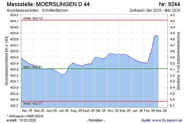
Groundwater level [m above sealevel]: 423.61
Distance to surface [m]: 4.79
Last value from 15.04.2024 10:00
Ground level [m above sealevel]: 428.40
| Date | Groundwater level [m above sealevel] |
|---|---|
| 14.04.2024 | 423.62 |
| 13.04.2024 | 423.62 |
| 12.04.2024 | 423.63 |
| 11.04.2024 | 423.63 |
| 10.04.2024 | 423.64 |
| 09.04.2024 | 423.65 |
| 08.04.2024 | 423.65 |
| 07.04.2024 | 423.66 |
© Bayerisches Landesamt für Umwelt 2024