
- Start >
- Groundwater >
- Waterlevel of upper layer >
- Iller - Lech - Bodensee >
- BERGHEIM B/Q 790 >
- Current data

Current data BERGHEIM B/Q 790
Groundwater levels of the last 12 months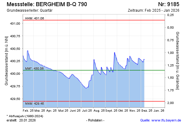
Groundwater level [m above sealevel]: 430.41
Distance to surface [m]: 1.01
Last value from 09.02.2024 09:40
Ground level [m above sealevel]: 431.42
| Date | Groundwater level [m above sealevel] |
|---|---|
| 09.02.2024 | 430.39 |
| 08.02.2024 | 430.38 |
| 07.02.2024 | 430.38 |
| 06.02.2024 | 430.39 |
| 05.02.2024 | 430.40 |
| 04.02.2024 | 430.41 |
| 03.02.2024 | 430.42 |
| 02.02.2024 | 430.43 |
© Bayerisches Landesamt für Umwelt 2024