
- Start >
- Groundwater >
- Waterlevel of upper layer >
- Bayern >
- WALDKRAIBG STA O 745 >
- Chart of total period

Chart of total period WALDKRAIBG STA O 745
Groundwater levels of the total period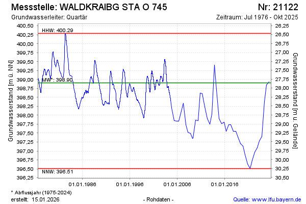
note
Beobachtung nur mehr halbjährlich
Groundwater level [m above sealevel]: 398.37
Distance to surface [m]: 28.39
Last value from 18.04.2024 10:39
Ground level [m above sealevel]: 426.76
| Date | Groundwater level [m above sealevel] |
|---|---|
| 19.10.2023 | 397.41 |
| 01.10.2023 | -- |
| 30.09.2023 | -- |
| 29.09.2023 | -- |
| 28.09.2023 | -- |
| 27.09.2023 | -- |
| 26.09.2023 | -- |
| 25.09.2023 | -- |
© Bayerisches Landesamt für Umwelt 2024