
- Start >
- Groundwater >
- Waterlevel of upper layer >
- Bayern >
- Thal, Prielweg >
- Current data

Current data Thal, Prielweg
Groundwater levels of the last 12 months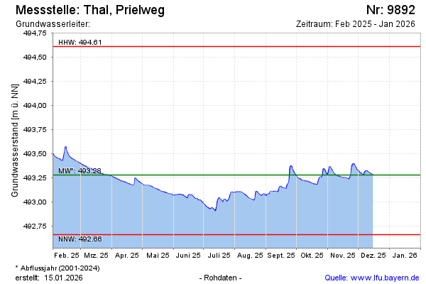
Groundwater level [m above sealevel]: 493.70
Distance to surface [m]:
Last value from 08.02.2024 14:12
Ground level [m above sealevel]: --
| Date | Groundwater level [m above sealevel] |
|---|---|
| 08.02.2024 | 493.70 |
| 07.02.2024 | 493.70 |
| 06.02.2024 | 493.71 |
| 05.02.2024 | 493.71 |
| 04.02.2024 | 493.72 |
| 03.02.2024 | 493.72 |
| 02.02.2024 | 493.72 |
| 01.02.2024 | 493.72 |
© Bayerisches Landesamt für Umwelt 2024