
- Start >
- Groundwater >
- Waterlevel of upper layer >
- Bayern >
- SCHILTORN-LÖSCHWASSER >
- Chart of total period

Chart of total period SCHILTORN-LÖSCHWASSER
Groundwater levels of the total period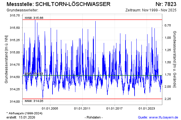
Groundwater level [m above sealevel]: 314.45
Distance to surface [m]: 1.85
Last value from 10.09.2025 13:05
Ground level [m above sealevel]: 316.30
| Date | Groundwater level [m above sealevel] |
|---|---|
| 10.09.2025 | 314.45 |
| 09.09.2025 | 314.45 |
| 08.09.2025 | 314.46 |
| 07.09.2025 | 314.50 |
| 06.09.2025 | 314.52 |
| 05.09.2025 | 314.39 |
| 04.09.2025 | 314.37 |
| 03.09.2025 | 314.37 |
© Bayerisches Landesamt für Umwelt 2025