
- Start >
- Groundwater >
- Waterlevel of upper layer >
- Bayern >
- LANGWEID 557 >
- Chart of total period

Chart of total period LANGWEID 557
Groundwater levels of the total period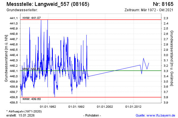
Groundwater level [m above sealevel]: 440.04
Distance to surface [m]: 3.36
Last value from 05.10.2021 10:00
Ground level [m above sealevel]: 443.40
| Date | Groundwater level [m above sealevel] |
|---|---|
| 22.05.2017 | 440.25 |
| 06.09.2016 | 440.13 |
| 18.06.2015 | 440.34 |
| 12.11.2014 | 440.04 |
| 07.05.2014 | 440.21 |
| 27.12.1995 | 439.99 |
| 18.12.1995 | 439.94 |
| 11.12.1995 | 439.99 |
© Bayerisches Landesamt für Umwelt 2024