
- Start >
- Groundwater >
- Waterlevel of upper layer >
- Bayern >
- Flussraummanagement Vils ZA 15 >
- Chart of total period

Chart of total period Flussraummanagement Vils ZA 15
Groundwater levels of the total period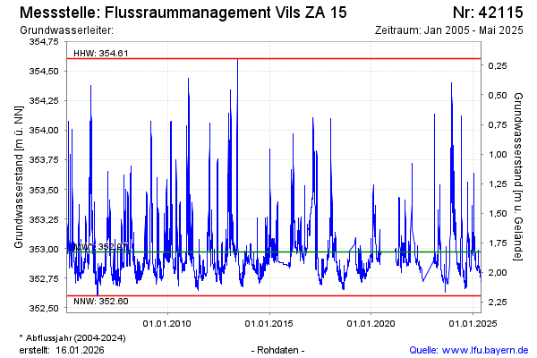
Groundwater level [m above sealevel]: 352.86
Distance to surface [m]: 1.94
Last value from 17.04.2024 09:00
Ground level [m above sealevel]: 354.80
| Date | Groundwater level [m above sealevel] |
|---|---|
| 17.04.2024 | 352.85 |
| 16.04.2024 | 352.84 |
| 15.04.2024 | 352.82 |
| 14.04.2024 | 352.81 |
| 13.04.2024 | 352.81 |
| 12.04.2024 | 352.81 |
| 11.04.2024 | 352.81 |
| 10.04.2024 | 352.81 |
© Bayerisches Landesamt für Umwelt 2024