
- Start >
- Groundwater >
- Waterlevel of upper layer >
- Bayern >
- Erlau Q 4 >
- Chart of total period

Chart of total period Erlau Q 4
Groundwater levels of the total period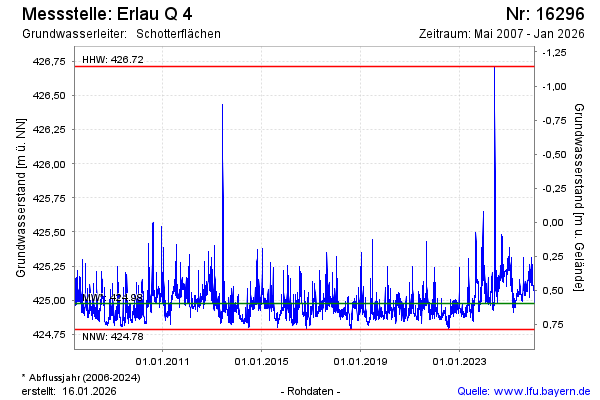
Groundwater level [m above sealevel]: 425.21
Distance to surface [m]: 0.36
Last value from 22.04.2024 10:00
Ground level [m above sealevel]: 425.57
| Date | Groundwater level [m above sealevel] |
|---|---|
| 22.04.2024 | 425.22 |
| 21.04.2024 | 425.15 |
| 20.04.2024 | 425.15 |
| 19.04.2024 | 425.15 |
| 18.04.2024 | 425.17 |
| 17.04.2024 | 425.14 |
| 16.04.2024 | 425.10 |
| 15.04.2024 | 425.07 |
© Bayerisches Landesamt für Umwelt 2024