
- Start >
- Groundwater >
- Waterlevel of upper layer >
- Bayern >
- Burgau HWS N1 >
- Chart of total period

Chart of total period Burgau HWS N1
Groundwater levels of the total period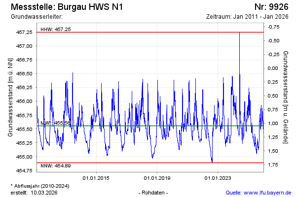
Groundwater level [m above sealevel]: 455.16
Distance to surface [m]: 1.44
Last value from 21.08.2025 13:15
Ground level [m above sealevel]: 456.60
| Date | Groundwater level [m above sealevel] |
|---|---|
| 21.08.2025 | 455.16 |
| 20.08.2025 | 455.17 |
| 19.08.2025 | 455.18 |
| 18.08.2025 | 455.19 |
| 17.08.2025 | 455.20 |
| 16.08.2025 | 455.21 |
| 15.08.2025 | 455.22 |
| 14.08.2025 | 455.23 |
© Bayerisches Landesamt für Umwelt 2025