
- Start >
- Groundwater >
- Waterlevel of upper layer >
- Bayern >
- BK16 - HW-TS-Süd >
- Chart of total period

Chart of total period BK16 - HW-TS-Süd
Groundwater levels of the total period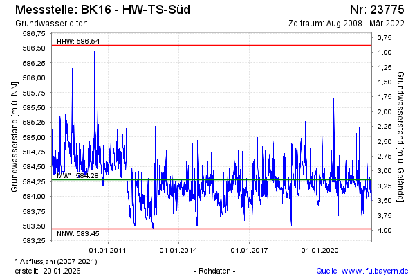
Groundwater level [m above sealevel]: 584.09
Distance to surface [m]: 3.34
Last value from 17.03.2022 16:01
Ground level [m above sealevel]: 587.43
| Date | Groundwater level [m above sealevel] |
|---|---|
| 17.03.2022 | 584.10 |
| 16.03.2022 | 584.02 |
| 15.03.2022 | 583.95 |
| 14.03.2022 | 583.94 |
| 13.03.2022 | 583.94 |
| 12.03.2022 | 583.94 |
| 11.03.2022 | 583.93 |
| 10.03.2022 | 583.93 |
© Bayerisches Landesamt für Umwelt 2024