
- Start >
- Groundwater >
- Waterlevel of deep layer >
- Regnitz >
- RÖCKERSBÜHL Kms1 >
- Chart of total period

Chart of total period RÖCKERSBÜHL Kms1
Groundwater levels of the total period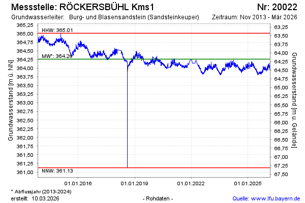
Groundwater level [m above sealevel]: 364.11
Distance to surface [m]: 64.33
Last value from 18.04.2024 10:00
Ground level [m above sealevel]: 428.44
| Date | Groundwater level [m above sealevel] |
|---|---|
| 17.04.2024 | 364.15 |
| 16.04.2024 | 364.16 |
| 15.04.2024 | 364.14 |
| 14.04.2024 | 364.09 |
| 13.04.2024 | 364.06 |
| 12.04.2024 | 364.04 |
| 11.04.2024 | 364.04 |
| 10.04.2024 | 364.06 |
© Bayerisches Landesamt für Umwelt 2024