
- Start >
- Groundwater >
- Waterlevel of deep layer >
- Isar >
- Moorenweis T 15 >
- Chart of total period

Chart of total period Moorenweis T 15
Groundwater levels of the total period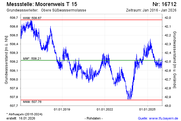
Groundwater level [m above sealevel]: 508.21
Distance to surface [m]: 42.49
Last value from 24.04.2024 09:00
Ground level [m above sealevel]: 550.70
| Date | Groundwater level [m above sealevel] |
|---|---|
| 24.04.2024 | 508.20 |
| 23.04.2024 | 508.19 |
| 22.04.2024 | 508.18 |
| 21.04.2024 | 508.18 |
| 20.04.2024 | 508.19 |
| 19.04.2024 | 508.19 |
| 18.04.2024 | 508.19 |
| 17.04.2024 | 508.21 |
© Bayerisches Landesamt für Umwelt 2024