
- Start >
- Groundwater >
- Waterlevel of deep layer >
- Bayern >
- Schmausenbuck (K-11) >
- Chart of total period

Chart of total period Schmausenbuck (K-11)
Groundwater levels of the total period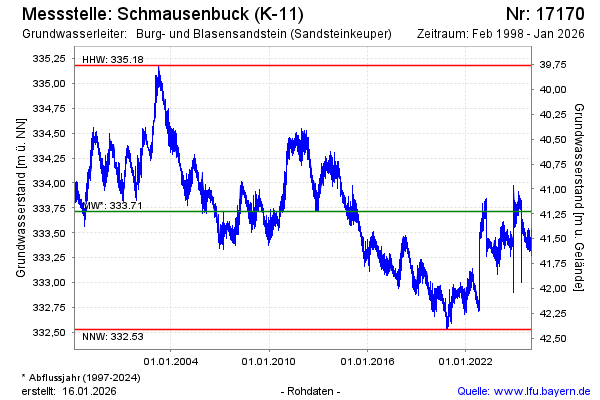
Groundwater level [m above sealevel]: 333.30
Distance to surface [m]: 41.64
Last value from 27.11.2025 10:00
Ground level [m above sealevel]: 374.94
| Date | Groundwater level [m above sealevel] |
|---|---|
| 27.11.2025 | 333.31 |
| 26.11.2025 | 333.34 |
| 25.11.2025 | 333.45 |
| 24.11.2025 | 333.53 |
| 23.11.2025 | 333.47 |
| 22.11.2025 | 333.33 |
| 21.11.2025 | 333.33 |
| 20.11.2025 | 333.43 |
© Bayerisches Landesamt für Umwelt 2025