
- Start >
- Groundwater >
- Waterlevel of deep layer >
- Bayern >
- OTTERW./NIEDERRIEDEN >
- Chart of total period

Chart of total period OTTERW./NIEDERRIEDEN
Groundwater levels of the total period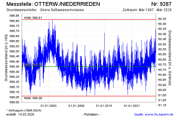
Groundwater level [m above sealevel]: 586.44
Distance to surface [m]: 60.63
Last value from 08.12.2025 04:00
Ground level [m above sealevel]: 647.07
| Date | Groundwater level [m above sealevel] |
|---|---|
| 07.12.2025 | 586.47 |
| 06.12.2025 | 586.49 |
| 05.12.2025 | 586.50 |
| 04.12.2025 | 586.51 |
| 03.12.2025 | 586.48 |
| 02.12.2025 | 586.46 |
| 01.12.2025 | 586.43 |
| 30.11.2025 | 586.48 |
© Bayerisches Landesamt für Umwelt 2025