
- Start >
- Groundwater >
- Waterlevel of deep layer >
- Bayern >
- Eschenried T 17t >
- Chart of total period

Chart of total period Eschenried T 17t
Groundwater levels of the total period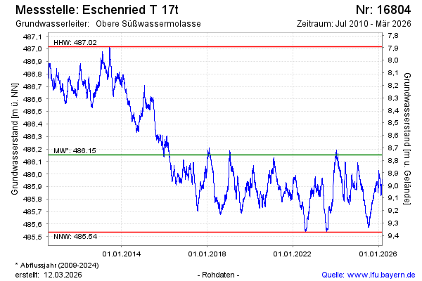
Groundwater level [m above sealevel]: 485.94
Distance to surface [m]: 8.98
Last value from 18.04.2024 10:00
Ground level [m above sealevel]: 494.92
| Date | Groundwater level [m above sealevel] |
|---|---|
| 18.04.2024 | 485.95 |
| 17.04.2024 | 485.95 |
| 16.04.2024 | 485.96 |
| 15.04.2024 | 485.95 |
| 14.04.2024 | 485.94 |
| 13.04.2024 | 485.93 |
| 12.04.2024 | 485.93 |
| 11.04.2024 | 485.93 |
© Bayerisches Landesamt für Umwelt 2024