
- Start >
- Groundwater >
- Waterlevel of deep layer >
- Bayern >
- Ebrantshausen T3 >
- Chart of total period

Chart of total period Ebrantshausen T3
Groundwater levels of the total period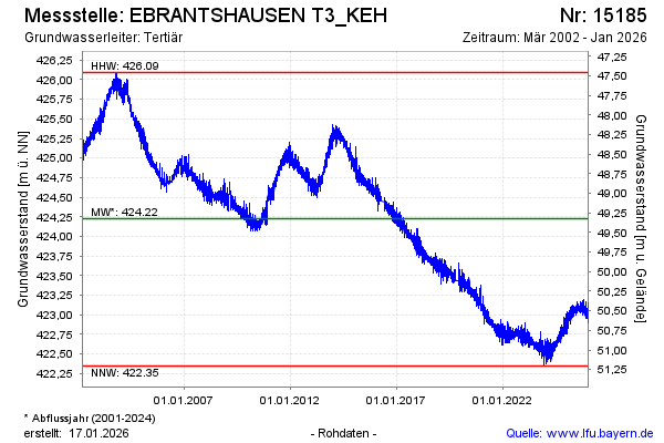
Groundwater level [m above sealevel]: 422.53
Distance to surface [m]: 51.02
Last value from 18.04.2024 10:00
Ground level [m above sealevel]: 473.55
| Date | Groundwater level [m above sealevel] |
|---|---|
| 18.04.2024 | 422.56 |
| 17.04.2024 | 422.60 |
| 16.04.2024 | 422.63 |
| 15.04.2024 | 422.63 |
| 14.04.2024 | 422.56 |
| 13.04.2024 | 422.50 |
| 12.04.2024 | 422.44 |
| 11.04.2024 | 422.40 |
© Bayerisches Landesamt für Umwelt 2024