
- Startseite >
- Seen >
- Wasserstand >
- Untere Donau >
- Postmünster Seepegel >
- Monatsgrafik

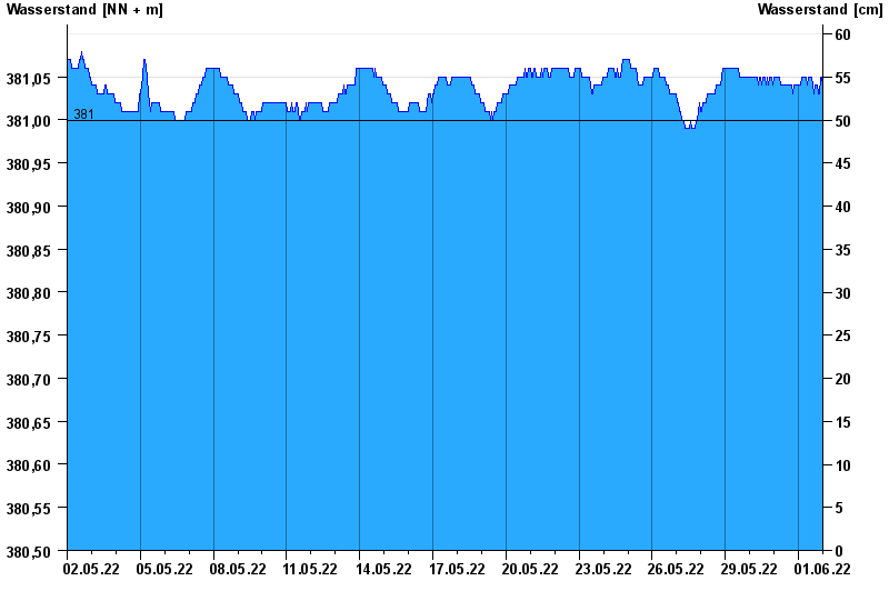
Monatsgrafik Postmünster Seepegel / Rottauensee
Wasserstand vom 02.05.2022 bis zum 01.06.2022
- 377,60 m ü. NN : Rottauensee: Tiefstes Absenkziel
- 381,00 m ü. NN : Rottauensee: Stauziel
- 388,00 m ü. NN : Rottauensee: Hochwasserstauziel
- 389,80 m ü. NN : Rottauensee: Dammkrone
- 387,00 m ü. NN : Rottauensee: Vollstau
Linien: keine | Hauptwerte | Meldestufen | mittlerer Seespiegel | Hochwassermarken | historische Ereignisse
| Datum | Wasserstand [m ü. NN] |
|---|---|
| 02.06.2022 00:45 | 381,04 |
| 02.06.2022 00:30 | 381,04 |
| 02.06.2022 00:15 | 381,04 |
| 02.06.2022 00:00 | 381,04 |
| 01.06.2022 23:45 | 381,04 |
| 01.06.2022 23:30 | 381,04 |
| 01.06.2022 23:15 | 381,05 |
© Bayerisches Landesamt für Umwelt 2024