
- Startseite >
- Flüsse >
- Wasserstand >
- Regnitz >
- Staudach >
- Jahresgrafik

Jahresgrafik Staudach / Tiroler Achen
Wasserstand vom 01.01.2019 bis zum 31.12.2019
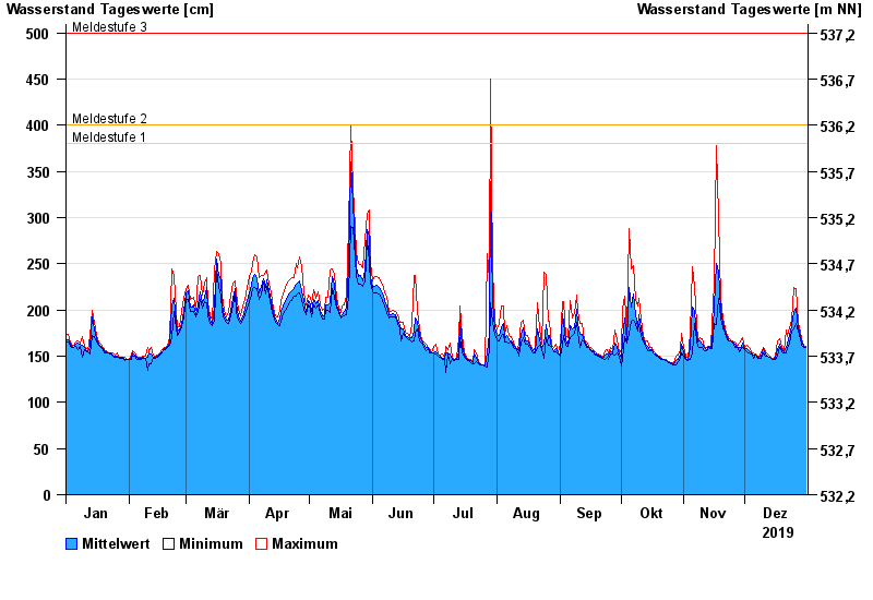
- Meldestufe 1 380 cm
- Meldestufe 2 400 cm
- Meldestufe 3 500 cm
- Meldestufe 4 550 cm
- Hochwassergefahrenfläche HQhäufig 510 cm
- Hochwassergefahrenfläche HQ100 650 cm
| Datum | Mittelwert [cm] | Maximum [cm] | Minimum [cm] |
|---|---|---|---|
| 31.12.2019 | 160 | 161 | 159 |
| 30.12.2019 | 161 | 162 | 160 |
| 29.12.2019 | 165 | 169 | 162 |
| 28.12.2019 | 172 | 177 | 169 |
| 27.12.2019 | 181 | 186 | 177 |
| 26.12.2019 | 202 | 223 | 186 |
| 25.12.2019 | 199 | 225 | 179 |
© Bayerisches Landesamt für Umwelt 2025