
- Startseite >
- Flüsse >
- Wasserstand >
- Untere Donau >
- Plattling >
- Jahresgrafik

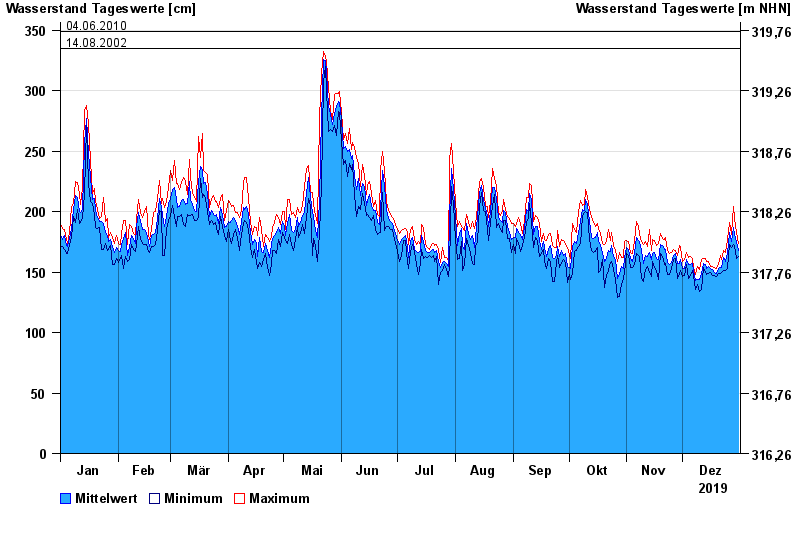
Jahresgrafik Plattling / Isar
Wasserstand vom 01.01.2019 bis zum 31.12.2019
- 04.06.2013 Wasserstand: 400 cm
- 24.05.1999 Wasserstand: 378 cm
- 25.08.2005 Wasserstand: 374 cm
- 04.06.2010 Wasserstand: 349 cm
- 14.08.2002 Wasserstand: 335 cm
| Datum | Mittelwert [cm] | Maximum [cm] | Minimum [cm] |
|---|---|---|---|
| 31.12.2019 | 168 | 174 | 163 |
| 30.12.2019 | 175 | 183 | 161 |
| 29.12.2019 | 181 | 194 | 172 |
| 28.12.2019 | 187 | 204 | 173 |
| 27.12.2019 | 175 | 181 | 170 |
| 26.12.2019 | 183 | 191 | 173 |
| 25.12.2019 | 165 | 177 | 153 |
© Bayerisches Landesamt für Umwelt 2024