
- Startseite >
- Flüsse >
- Wasserstand >
- Untere Donau >
- Landshut Birket >
- Jahresgrafik

Jahresgrafik Landshut Birket / Isar
Wasserstand vom 19.05.2022 bis zum 18.05.2023
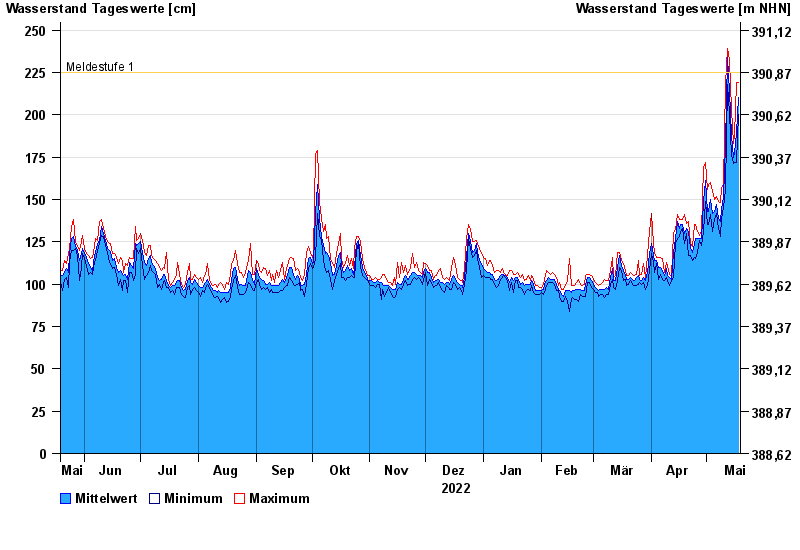
- Meldestufe 1 225 cm
- Meldestufe 3 310 cm
- Meldestufe 4 380 cm
- Hochwassergefahrenfläche HQ100 380 cm
| Datum | Mittelwert [cm] | Maximum [cm] | Minimum [cm] |
|---|---|---|---|
| 18.05.2023 | 210 | 219 | 200 |
| 17.05.2023 | 189 | 219 | 172 |
| 16.05.2023 | 177 | 188 | 172 |
| 15.05.2023 | 175 | 183 | 171 |
| 14.05.2023 | 188 | 203 | 176 |
| 13.05.2023 | 214 | 232 | 201 |
| 12.05.2023 | 234 | 239 | 218 |
© Bayerisches Landesamt für Umwelt 2024