
- Startseite >
- Flüsse >
- Wasserstand >
- Untere Donau >
- Erlau >
- Jahresgrafik

Jahresgrafik Erlau / Donau
Wasserstand vom 01.01.2017 bis zum 31.12.2017
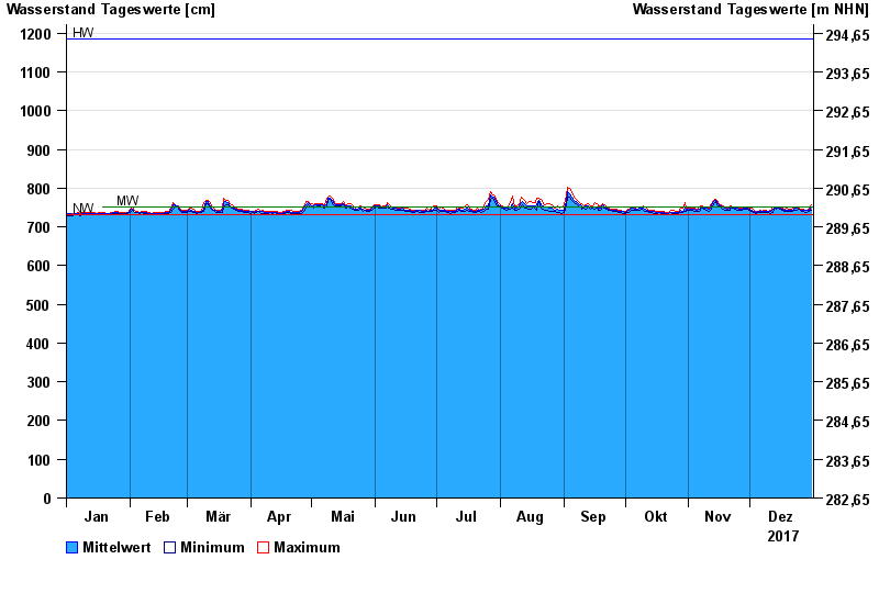
| Datum | Mittelwert [cm] | Maximum [cm] | Minimum [cm] |
|---|---|---|---|
| 31.12.2017 | 751 | 757 | 743 |
| 30.12.2017 | 742 | 745 | 739 |
| 29.12.2017 | 742 | 744 | 738 |
| 28.12.2017 | 742 | 744 | 738 |
| 27.12.2017 | 743 | 746 | 740 |
| 26.12.2017 | 744 | 746 | 741 |
| 25.12.2017 | 746 | 748 | 745 |
© Bayerisches Landesamt für Umwelt 2024