
- Startseite >
- Flüsse >
- Wasserstand >
- Untere Donau >
- Erlau >
- Jahresgrafik

Jahresgrafik Erlau / Donau
Wasserstand vom 21.10.2021 bis zum 20.10.2022
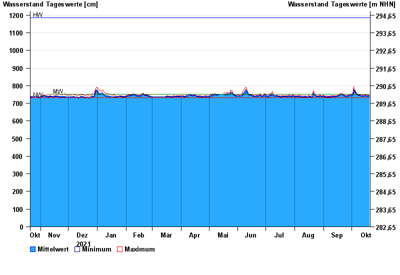
| Datum | Mittelwert [cm] | Maximum [cm] | Minimum [cm] |
|---|---|---|---|
| 20.10.2022 | 742 | 745 | 739 |
| 19.10.2022 | 742 | 745 | 739 |
| 18.10.2022 | 742 | 746 | 738 |
| 17.10.2022 | 744 | 748 | 741 |
| 16.10.2022 | 745 | 749 | 742 |
| 15.10.2022 | 744 | 747 | 741 |
| 14.10.2022 | 743 | 747 | 740 |
© Bayerisches Landesamt für Umwelt 2024