
- Startseite >
- Flüsse >
- Wasserstand >
- Untere Donau >
- Chamerau >
- Jahresgrafik

Jahresgrafik Chamerau / Regen
Wasserstand vom 03.08.2021 bis zum 02.08.2022
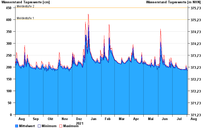
- Meldestufe 1 400 cm
- Meldestufe 2 450 cm
- Meldestufe 3 500 cm
- Meldestufe 4 600 cm
- Hochwassergefahrenfläche HQ100 610 cm
| Datum | Mittelwert [cm] | Maximum [cm] | Minimum [cm] |
|---|---|---|---|
| 02.08.2022 | 187 | 195 | 185 |
| 01.08.2022 | 192 | 193 | 186 |
| 31.07.2022 | 196 | 198 | 193 |
| 30.07.2022 | 201 | 209 | 191 |
| 29.07.2022 | 189 | 191 | 188 |
| 28.07.2022 | 188 | 189 | 188 |
| 27.07.2022 | 190 | 191 | 189 |
© Bayerisches Landesamt für Umwelt 2024