
- Startseite >
- Flüsse >
- Wasserstand >
- Untere Donau >
- Chamerau >
- Jahresgrafik

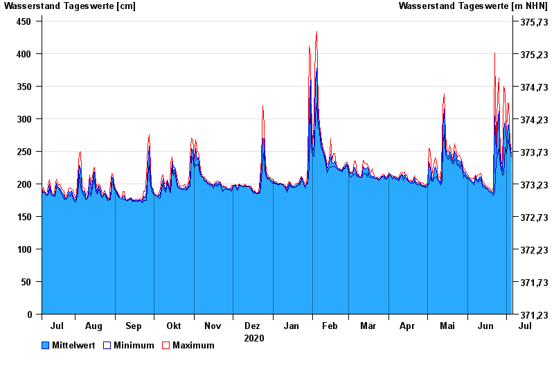
Jahresgrafik Chamerau / Regen
Wasserstand vom 06.07.2020 bis zum 05.07.2021
- 13.08.2002 Wasserstand: 680 cm
- 21.12.1993 Wasserstand: 600 cm
- 22.07.1980 Wasserstand: 575 cm
- 01.11.1998 Wasserstand: 555 cm
- 21.03.2002 Wasserstand: 543 cm
| Datum | Mittelwert [cm] | Maximum [cm] | Minimum [cm] |
|---|---|---|---|
| 05.07.2021 | 247 | 253 | 241 |
| 04.07.2021 | 258 | 264 | 253 |
| 03.07.2021 | 290 | 322 | 264 |
| 02.07.2021 | 290 | 324 | 269 |
| 01.07.2021 | 264 | 285 | 247 |
| 30.06.2021 | 297 | 338 | 256 |
| 29.06.2021 | 283 | 350 | 215 |
© Bayerisches Landesamt für Umwelt 2024